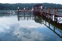
Alabama Fishing Spots

H. Neely Henry Lake
Avg. Rating: 5
# Reviews: 1
Views: 1545

William (Bill) Dannelly Reservoir
Avg. Rating: 5
# Reviews: 1
Views: 2840
South Sauty Creek
Avg. Rating: 5
# Reviews: 1
Views: 1211
Mill Creek
Avg. Rating: 5
# Reviews: 1
Views: 1358
French Creek
Avg. Rating: 4
# Reviews: 1
Views: 1352
Mills Creek
Avg. Rating: 4
# Reviews: 1
Views: 661
|
|
Mills Creek
Species: - |
Map It | |
|
|
Mitchell Lake
Species: - |
No Rewiews
Views: 180
Review Location |
Map It |
|
|
Mitchell Lake Dam
Species: - |
No Rewiews
Views: 188
Review Location |
Map It |
 Dec 31, 1969
|
Mobile Bay
Mobile Bay is an inlet of the Gulf of Mexico, lying within the state of Alabama in the United States. Its mouth is formed by the Fort Morgan Peninsula... |
No Rewiews
Views: 393
Review Location |
Map It |
 Dec 31, 1969
|
Mobile River
The Mobile River is located in southern Alabama in the United States. Formed out of the confluence of the Tombigbee and Alabama rivers, the approximat... |
No Rewiews
Views: 545
Review Location |
Map It |
 Dec 31, 1969
|
Monroe County Public Lake
Monroe County Lake is a 94-acre lake located 5 miles west of Beatrice off County Road 50. Directions: From Monroeville take Alabama Hwy 21 north to Be... |
No Rewiews
Views: 243
Review Location |
Map It |
|
|
Mortar Creek
Species: - |
No Rewiews
Views: 261
Review Location |
Map It |
|
|
Mud Creek
Species: - |
No Rewiews
Views: 205
Review Location |
Map It |
|
|
Mulberry Creek
Mulberry Creek is a short tributary of the Tennessee River in northern Alabama in the United States. [1] |
No Rewiews
Views: 195
Review Location |
Map It |
|
|
Mulberry Fork
Mulberry Fork is a tributary of the Black Warrior River, 102 miles (164 km) long, in the U.S. state of Alabama.[1] The Mulberry Fork is one of three... |
No Rewiews
Views: 212
Review Location |
Map It |